Remote Sensing of Teotihuacan: How Cutting-Edge Technology is Transforming Our Understanding of an Ancient City. Discover the Secrets Buried Beneath the Surface.
- Introduction: The Significance of Teotihuacan
- Remote Sensing Technologies Used at Teotihuacan
- Major Discoveries Enabled by Remote Sensing
- Mapping Urban Layouts and Subterranean Features
- Challenges and Limitations of Remote Sensing in Archaeology
- Integrating Remote Sensing Data with Traditional Archaeology
- Future Prospects: What Lies Ahead for Teotihuacan Research
- Conclusion: The Impact of Remote Sensing on Mesoamerican Archaeology
- Sources & References
Introduction: The Significance of Teotihuacan
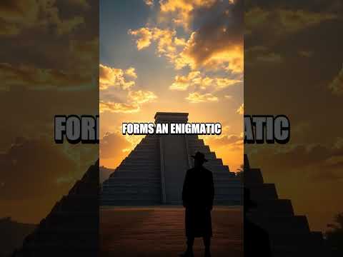
Teotihuacan, located in the Basin of Mexico, stands as one of the most significant archaeological sites in the Americas, renowned for its monumental architecture, urban planning, and influence on later Mesoamerican cultures. At its peak between 100 BCE and 550 CE, Teotihuacan was among the largest cities in the world, with a population estimated at over 100,000 inhabitants. The city’s iconic features, such as the Pyramid of the Sun, the Pyramid of the Moon, and the Avenue of the Dead, reflect a sophisticated society with complex religious, political, and economic systems. Despite extensive excavations, much of Teotihuacan’s urban layout, subsurface features, and the daily lives of its inhabitants remain shrouded in mystery due to centuries of urban development and natural processes that have altered the landscape.
Remote sensing technologies have revolutionized the study of Teotihuacan by enabling archaeologists to investigate the site’s hidden structures and landscape modifications without intrusive excavation. Techniques such as aerial photography, LiDAR (Light Detection and Ranging), and satellite imagery have revealed previously unknown architectural complexes, roadways, and water management systems, offering new insights into the city’s organization and growth. These non-invasive methods are crucial for preserving the integrity of the site while expanding our understanding of its historical significance. The integration of remote sensing data with traditional archaeological research continues to reshape interpretations of Teotihuacan’s development, social dynamics, and its enduring legacy in Mesoamerican history Instituto Nacional de Antropología e Historia NASA.
Remote Sensing Technologies Used at Teotihuacan
Remote sensing technologies have played a transformative role in the study of Teotihuacan, enabling archaeologists to investigate the ancient city’s vast urban landscape without intrusive excavation. Among the most significant tools are aerial photography, satellite imagery, LiDAR (Light Detection and Ranging), and ground-penetrating radar (GPR). Early aerial surveys provided the first comprehensive maps of Teotihuacan’s layout, revealing the scale and organization of its monumental architecture and residential compounds. More recently, high-resolution satellite imagery has allowed researchers to monitor changes in the site and identify previously unrecorded features, such as buried structures and ancient roadways, by analyzing subtle variations in vegetation and soil patterns (NASA).
LiDAR has been particularly revolutionary, as it can penetrate dense vegetation and generate detailed 3D models of the ground surface. At Teotihuacan, LiDAR surveys have uncovered hidden architectural features, mapped the extent of urban sprawl, and provided new insights into the city’s planning and water management systems (Smithsonian Institution). Ground-penetrating radar complements these methods by detecting subsurface anomalies, such as tombs, tunnels, and construction phases, without disturbing the archaeological context (National Geographic Society).
The integration of these remote sensing technologies has not only expanded the known boundaries of Teotihuacan but also refined our understanding of its social, political, and economic organization, demonstrating the power of non-invasive methods in archaeological research.
Major Discoveries Enabled by Remote Sensing
Remote sensing technologies have revolutionized the study of Teotihuacan, enabling archaeologists to uncover major discoveries that were previously inaccessible or invisible through traditional excavation. One of the most significant breakthroughs was the identification of extensive urban planning and hidden architectural features beneath the modern surface. Using LiDAR (Light Detection and Ranging), researchers mapped the entire city, revealing a complex grid of streets, residential compounds, and previously unknown structures, including smaller temples and plazas that had been obscured by centuries of sediment and urban development (NASA).
Remote sensing has also led to the discovery of large-scale water management systems, such as canals and reservoirs, which highlight the city’s sophisticated engineering and adaptation to its environment. Aerial and satellite imagery have been instrumental in tracing the extent of these hydraulic features, providing insights into how Teotihuacan sustained its large population (Instituto Nacional de Antropología e Historia).
Furthermore, multispectral and thermal imaging have detected subsurface anomalies, guiding targeted excavations that uncovered tombs, caches of offerings, and evidence of ritual activity. These discoveries have deepened our understanding of Teotihuacan’s social, religious, and political organization, demonstrating the transformative impact of remote sensing on Mesoamerican archaeology (National Geographic).
Mapping Urban Layouts and Subterranean Features
Remote sensing technologies have revolutionized the mapping of Teotihuacan’s urban layouts and subterranean features, providing unprecedented insights into the city’s spatial organization and hidden structures. High-resolution satellite imagery and aerial LiDAR (Light Detection and Ranging) have enabled researchers to delineate the city’s grid-like street patterns, residential compounds, and monumental architecture with remarkable precision, even beneath dense vegetation or modern development. These methods have revealed the extent of Teotihuacan’s urban planning, including the alignment of the Avenue of the Dead and the distribution of neighborhoods, plazas, and civic-religious complexes NASA.
Subterranean features, such as tunnels, caves, and buried chambers, have also been detected using ground-penetrating radar (GPR) and electrical resistivity tomography (ERT). These non-invasive techniques have uncovered previously unknown passageways beneath major pyramids, including the Pyramid of the Sun and the Temple of the Feathered Serpent, suggesting ritual or hydraulic functions Instituto Nacional de Antropología e Historia (INAH). The integration of remote sensing data with archaeological excavation has allowed for more targeted and less destructive investigations, refining our understanding of Teotihuacan’s complex urban fabric and its underlying infrastructure. As a result, remote sensing continues to play a critical role in reconstructing the ancient city’s landscape and in guiding future research and conservation efforts.
Challenges and Limitations of Remote Sensing in Archaeology
Remote sensing has revolutionized archaeological research at Teotihuacan, enabling the detection of buried structures, mapping of urban layouts, and analysis of landscape modifications. However, several challenges and limitations persist in its application. One significant issue is the resolution of satellite and aerial imagery; while high-resolution data can reveal surface features, subsurface remains—such as tunnels or deeply buried architecture—often remain undetectable without complementary ground-based methods like geophysical surveys or targeted excavations (NASA).
Environmental factors also complicate remote sensing at Teotihuacan. Dense vegetation, modern urban encroachment, and agricultural activity can obscure or alter archaeological features, leading to misinterpretation or data loss. Seasonal changes, such as rainfall or crop cycles, further affect the visibility of features in multispectral or LiDAR data (Esri).
Interpretation of remote sensing data requires specialized expertise and is subject to bias. Distinguishing between natural and anthropogenic features can be challenging, especially in a complex urban landscape like Teotihuacan. Additionally, the integration of remote sensing results with traditional archaeological data is not always straightforward, necessitating interdisciplinary collaboration and robust validation through fieldwork (National Geographic).
Finally, access to high-quality remote sensing data can be limited by cost, legal restrictions, or technical barriers, particularly for researchers in resource-constrained settings. These challenges underscore the need for continued methodological innovation and collaboration to fully realize the potential of remote sensing in uncovering Teotihuacan’s past.
Integrating Remote Sensing Data with Traditional Archaeology
Integrating remote sensing data with traditional archaeological methods has significantly advanced the study of Teotihuacan, one of Mesoamerica’s most enigmatic ancient cities. Remote sensing technologies—such as LiDAR, aerial photography, and satellite imagery—provide large-scale, non-invasive perspectives that complement the detailed, context-rich information gathered through excavation and surface survey. For example, LiDAR has revealed previously undetected architectural features beneath dense vegetation and modern development, allowing archaeologists to map the city’s full extent and urban layout with unprecedented accuracy. These findings are then cross-referenced with ground-truthing and stratigraphic excavation, ensuring that remote observations are validated and contextualized within the broader archaeological record (NASA).
The integration process is iterative: remote sensing data can guide archaeologists to promising excavation sites, while discoveries made in the field can refine the interpretation of remote datasets. This synergy has led to the identification of new residential compounds, roadways, and water management systems, reshaping our understanding of Teotihuacan’s social organization and urban planning (Smithsonian Institution). Moreover, combining these approaches helps mitigate the risks of site disturbance and loss, as remote sensing can monitor changes over time and inform conservation strategies. Ultimately, the integration of remote sensing and traditional archaeology at Teotihuacan exemplifies how interdisciplinary collaboration can unlock new dimensions of ancient urban landscapes.
Future Prospects: What Lies Ahead for Teotihuacan Research
The future of Teotihuacan research is poised for significant advancements through the continued integration of remote sensing technologies. Emerging tools such as high-resolution LiDAR, drone-based photogrammetry, and multispectral satellite imagery are expected to revolutionize the mapping and analysis of the ancient city’s extensive urban landscape. These technologies can penetrate dense vegetation, reveal subtle topographical features, and detect buried structures without invasive excavation, offering new insights into Teotihuacan’s urban planning, hydrology, and social organization.
One promising direction is the use of machine learning algorithms to process and interpret the vast datasets generated by remote sensing. Automated pattern recognition can help identify previously unknown architectural features, roadways, and agricultural systems, potentially expanding the known boundaries of the city and its hinterlands. Additionally, the integration of remote sensing data with Geographic Information Systems (GIS) will facilitate more sophisticated spatial analyses, enabling researchers to model ancient land use, resource distribution, and population dynamics with unprecedented accuracy.
Collaborative, interdisciplinary projects are also likely to increase, as archaeologists, geographers, and computer scientists work together to refine methodologies and share findings. Open-access data initiatives and international partnerships will further democratize research, allowing for broader participation and comparative studies with other Mesoamerican sites. As these technologies become more accessible and affordable, the potential for non-invasive, large-scale exploration of Teotihuacan and its environs will only grow, promising a new era of discovery and understanding for one of the world’s most enigmatic ancient cities (NASA; Instituto Nacional de Antropología e Historia).
Conclusion: The Impact of Remote Sensing on Mesoamerican Archaeology
The application of remote sensing technologies at Teotihuacan has profoundly transformed the field of Mesoamerican archaeology. By employing tools such as LiDAR, aerial photography, and satellite imagery, researchers have been able to uncover previously unknown architectural features, map extensive urban layouts, and identify subsurface structures without invasive excavation. These advances have not only expanded our understanding of Teotihuacan’s urban planning and social organization but have also provided new insights into the broader patterns of settlement and interaction in ancient Mesoamerica. For instance, remote sensing has revealed the complexity of Teotihuacan’s residential compounds and the extent of its influence on surrounding regions, challenging earlier assumptions about the city’s development and decline NASA.
Moreover, remote sensing has facilitated more sustainable archaeological practices by minimizing ground disturbance and enabling targeted excavations. This approach preserves the integrity of fragile sites while maximizing the information gained from each intervention. The integration of remote sensing data with traditional archaeological methods has set a new standard for research in the region, fostering interdisciplinary collaboration and innovation. As technology continues to advance, the impact of remote sensing on Mesoamerican archaeology is likely to grow, offering unprecedented opportunities to explore, document, and protect the cultural heritage of sites like Teotihuacan for future generations Instituto Nacional de Antropología e Historia (INAH).
Sources & References